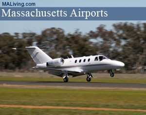
Plymouth Municipal Airport
Mass. Airports, Landing Strips
Plymouth Municipal Airport is a public airport owned by the town of Plymouth, Massachusetts. This airport averages about 300 flights a day. Browse the information below for more details on this New England airport. MA Living suggests you call to confirm the information before scheduling your flight.
Feature your local business in MA Living, contact us.
Plymouth Municipal Airport: MA Airports

Plymouth Municipal Airport
South Meadow Dr.
Plymouth, MA 02360
Ph: 508-746-2020
Location
FAA Identifier: PYM
Lat/Long: 41-54-32.5000N / 070-43-43.6000W
41-54.541667N / 070-43.726667W
41.9090278 / -70.7287778
(estimated)
Elevation
148 ft. / 45.1 m (surveyed)
Variation: 16W (1995)
From city: 4 miles SW of PLYMOUTH, MA
Time zone: UTC -5 (UTC -4 during Daylight Savings Time)
Zip code: 02360
Airport Operations
Airport use: Open to the public
Activation date: 03/1941
Sectional chart: NEW YORK
Control tower: no
ARTCC: BOSTON CENTER
FSS: BRIDGEPORT FLIGHT SERVICE STATION
NOTAMs facility: PYM (NOTAM-D service available)
Attendance: 0600-2200
Wind indicator: yes
Segmented circle: yes
Lights: DUSK-DAWN
ACTVT MIRL RYS 06/24; 15/33; MALSF RY 06 & REIL RY 24 – 122.900.
Beacon: white-green (lighted land airport)
Airport Communications
CTAF/UNICOM: 123.0
WX ASOS: 135.625 (508-746-8003)
CAPE APPROACH: 118.2
CAPE DEPARTURE: 118.2
CLEARANCE DELIVERY: 127.75
WX AWOS-3 at GHG (12 nm N): 120.0 (781-837-0555)
WX ASOS at TAN (13 nm W): 132.675 (508-824-5005)
WX ASOS at EWB (17 nm SW): PHONE 508-992-0195
APCH/DEP SVC PRVDD BY BOSTON ARTCC ON FREQS 128.75/290.3 (BARNSTABLE RCAG) WHEN CAPE APCH CTL CLSD.
Airport Services
Fuel available: 100LL JET-A
Parking: hangars and tiedowns
Airframe service: MAJOR
Powerplant service: MAJOR
Bottled oxygen: LOW
Bulk oxygen: LOW
Airport Operational Statistics
Aircraft based on the field: 144
Single engine airplanes: 109
Multi engine airplanes: 16
Jet airplanes: 7
Helicopters: 12
Aircraft operations
avg 216/day
63% local general aviation
32% transient general aviation
5% air taxi
<1% military
inns | hotels | resorts | rentals | attractions | dining | real estate
SHOP FWM LUGGAGE SALE
| Photo | Title | Price | Buy |
|---|---|---|---|

|
Badgley Mischka Diamond Hard Expandable Spinner Luggage Set (3 Piece) (Burgundy-Black Bars) | On Sale | |

|
NZBZ Vintage Luggage Sets Luxury Cute Suitcase Retro Trunk Luggage with TSA Lock for Men and Women 3 Pieces (Dark Green, 14" & 20" & 28") | On Sale | |

|
DELSEY Paris Chatelet Air 2.0 Hardside Luggage with Spinner Wheels, Angora, 2 Piece Set 21/28 | $524.99 | On Sale |

|
SwissGear 7739 Hardside Luggage Trunk with Spinner Wheels, White, 2-Piece Set (19/26) | $199.99 | On Sale |

|
DELSEY Paris St. Tropez Hardside Expandable Luggage with Spinner Wheels, Navy, 3-Piece Set (21/24/28) | $553.23 | On Sale |

|
DELSEY Paris Helium Aero Hardside Expandable Luggage with Spinner Wheels, Titanium, 3-Piece Set (19/25/29) | $499.99 | On Sale |

|
kensie Hudson Softside Spinner Luggage, Heather Gray, 3-Piece Set (16/20/28) | $164.43 | On Sale |

|
Travelpro Runway 2 Piece Luggage Set, Carry-on & Convertible Medium to Large 28-Inch Check-in Hardside Expandable Luggage, 8 Spinner Wheels, TSA Lock, Hardshell Suitcase, White | $269.99 | On Sale |

|
DELSEY Paris Titanium Hardside Expandable Luggage with Spinner Wheels, Graphite, 3-Piece Set (21/25/29) | $876.61 | On Sale |

|
Bric's Bellagio 2.0 Spinner Trunk - 32 Inch - Luxury Bags for Women and Men - TSA Approved Luggage - Olive | $498.00 | On Sale |

|
Bric's Bellagio 2.0 Spinner Trunk - 27 Inch - Luxury Bags for Women and Men - TSA Approved Luggage - Olive | $438.00 | On Sale |

|
KPL Large 32 inch duffel bags for men holdall leather travel bag overnight gym sports weekend bag | $98.99 | On Sale |

|
Genuine Leather Duffel | Travel Overnight Weekend Leather Bag | Sports Gym Duffel for Men (BROWN) | Leather Vacation Luggage Duffle Bag | $69.99 | On Sale |

|
Polare 23" Full Grain Cowhide Leather Gym Duffle Weekender Overnight Travel Duffel Bag For Men 42L | $199.99 | On Sale |

|
Leather Rolling Travel Duffle Bag for Men Women 21 inch with wheels Sports Overnight Weekend Duffel Gym Cabin Holdall with wheels for easy carry | $189.99 | On Sale |
Inns | Hotels | Resorts | Vacation Rentals
Real Estate | Products
Dining | Attractions | Business
History | Weather | Beaches
Fishing | Golfing | Towns
Art Galleries | Massachusetts Shopping
Free World Mall
Country Weddings | New England Recipes
Red Sox Gifts | Travel Destinations | New England Living


