Ware Airport
Mass. Airports, Landing Strips
Ware Airport is a small, privately owned airport located in Ware, Massachusetts. Feature your local business in MA Living, contact us.
Ware Airport: MA Airports


Ware Airport
265 Church St.
Ware, Ma 01082
Ph: 413-733-6948
Location
FAA Identifier: MA53
Lat/Long: 42-16-55.3310N / 072-12-53.2860W
42-16.922183N / 072-12.888100W
42.2820364 / -72.2148017
Elevation: 483 ft. / 147.2 m (surveyed)
Variation: 15W (1985)
From city: 2 miles NE of WARE, MA
Time zone: UTC -5 (UTC -4 during Daylight Savings Time)
Zip code: 01082
Airport Operations
Airport use: Private use. Permission required prior to landing
Activation date: 10/1947
Sectional chart: NEW YORK
Control tower: no
ARTCC: BOSTON CENTER
SS: BRIDGEPORT FLIGHT SERVICE STATION
Attendance: UNATNDD
Wind indicator: yes
Segmented circle: no
Airport Communications
WX ASOS at ORH (15 nm E): PHONE 508-795-7546
WX ASOS at ORE (18 nm N): 135.675 (978-544-6774)
Runway Information
Runway N/S
Dimensions: 2030 x 150 ft. / 619 x 46 m
Surface: turf
RUNWAY N RUNWAY S
Traffic pattern: left left
Airport Operational Statistics
Aircraft operations: avg 76/day *
53% transient general aviation
38% local general aviation
9% air taxi
<1% military

inns | hotels | resorts | rentals | attractions | dining | real estate
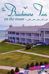
SUGGESTED MA BERKSHIRES LODGING Visit Western MA Vacation Specials. Browse current Amherst MA area vacation rentals, inns, resorts, and pet-friendly lodging availabilities below.SHOP FWM LUGGAGE SALE
| Photo | Title | Price | Buy |
|---|---|---|---|

|
Badgley Mischka Diamond Hard Expandable Spinner Luggage Set (3 Piece) (Burgundy-Black Bars) | On Sale | |

|
NZBZ Vintage Luggage Sets with Spinner Wheels Cute Carry On Suitcase Tsa Lock Luggage 3 Pieces (Green, 14inch & 20inch & 28inch) | On Sale | |

|
DELSEY PARIS Chatelet Air 2.0 Hardside Luggage with Spinner Wheels, Angora, 2 Piece Set, (20/28) | $660.98 | On Sale |

|
SwissGear 7739 Hardside Luggage Trunk with Spinner Wheels, White, 2-Piece Set (19/26) | $228.00 | On Sale |

|
DELSEY PARIS St. Tropez Hardside Expandable Luggage with Spinner Wheels, Navy, 3 Piece Set (21/24/28) | $839.99 | On Sale |

|
Delsey Luggage Aero 3 Piece Set (21"/25"/29") Spinner Suitcase (Platinum) | $589.99 | On Sale |
|
kensie Hudson Softside Spinner Luggage, Heather Gray, 3-Piece Set (16/20/28) | $146.98 | On Sale |

|
Travelpro Runway 2 Piece Luggage Set, Carry-on & Convertible Medium to Large 28-Inch Check-in Hardside Expandable Luggage, 8 Spinner Wheels, TSA Lock, Hardshell Suitcase, White | $269.99 | On Sale |

|
Delsey Luggage Titanium 3 Piece Set (21"/25"/29") Spinner Suitcase (Graphite) | On Sale | |

|
Bric's Bellagio 2.0 Spinner Suitcase - Luxury Hardshell Luggage with Large Wheels, Telescopic Handle, Leather Detailing - Rolling Carry-on or Checked Suitcase for Refined Travel | $415.00 | On Sale |

|
Bric's Bellagio 2.0 Spinner Suitcase - Luxury Hardshell Luggage with Large Wheels, Telescopic Handle, Leather Detailing - Rolling Carry-on or Checked Suitcase for Refined Travel | $365.00 | On Sale |

|
Large 32 inch duffel bags for men holdall leather travel bag overnight gym sports weekend bag | $98.99 | On Sale |

|
Genuine Leather Duffel | Travel Overnight Weekend Leather Bag | Sports Gym Duffel for Men (BROWN) | Leather Vacation Luggage Duffle Bag | $69.99 | On Sale |

|
Polare 23" Full Grain Cowhide Leather Gym Duffle Weekender Overnight Travel Duffel Bag For Men 42L | $199.99 | On Sale |

|
Leather Rolling Travel Duffle Bag for Men Women 21 inch with wheels Sports Overnight Weekend Duffel Gym Cabin Holdall with wheels for easy carry | $189.99 | On Sale |
Inns | Hotels | Resorts | Vacation Rentals
Real Estate | Products
Dining | Attractions | Business
History | Weather | Beaches
Fishing | Golfing | Towns
Art Galleries | Massachusetts Shopping
Free World Mall
Country Weddings | New England Recipes
Red Sox Gifts | Paradise Coast Living | New England Living