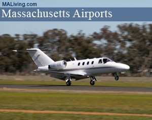
Westover Metropolitan Airport
Mass. Airports, Landing Strips
Westover Metropolitan Airport is owned and managed under a “joint use” agreement with Westover Metropolitan Corporation (a non-profit organization) and the Department of Defense. The corporation was built to develop property surplus by the General Services Administration at the former Westover Air Force Base. Ninety-one acres of that property is now used and operated as a public civilian airport. Feature your local business in MA Living, contact us.
Westover Metropolitan Airport: MA Airports
Browse the interactive MA lodging map below to find current hotel specials, vacation home rentals, and condos for rent.

Westover Metropolitan Airport
255 Padgette St.
Chicopee, MA 01022
Ph: 413-593-5543
Location
FAA Identifier: CEF
Lat/Long: 42-11-38.4500N / 072-32-05.2200W
42-11.640833N / 072-32.087000W
42.1940139 / -72.5347833
(estimated)
Elevation
241 ft. / 73.5 m (surveyed)
Variation: 15W (1985)
From city: 3 miles NE of central business district of the associated city
Time zone: UTC -5 (UTC -4 during Daylight Savings Time)
Zip code: 01022
Airport Operations
Airport use: Open to the public
Activation date: 07/1942
Sectional chart: NEW YORK
Control tower: yes
ARTCC: BOSTON CENTER
FSS: BURLINGTON FLIGHT SERVICE STATION
NOTAMs facility: CEF (NOTAM-D service available)
Attendance: 0700-2300
Pattern altitude: TFC PAT: RECTANGULAR LGT ACFT 1000′; LARGE ACFT 2000′; OVERHEAD 2500′.
Wind indicator: yes
Segmented circle: no
Lights: DUSK-2300
AFLD LGTS AVBL ONLY DUR OPERG HRS.
Beacon: white-white-green (lighted military airport)
CLEAR SIDE IS SPLIT. DAYLGT TURNED ON WHEN A/D IS IFR.
Landing fee: yes
Fire and rescue: ARFF index E
Airport Communications
CTAF: 134.85
UNICOM: 123.0
ATIS: 114.0 138.1 [0700-2300]
WESTOVER GROUND: 118.35 275.8 [0700-2300]
WESTOVER TOWER: 134.85 348.75 [0700-2300]
BRADLEY APPROACH: 125.35
BRADLEY DEPARTURE: 125.35
COMD POST 439 AW – (OPR 24 HOURS): 252.1
EMERG: 121.5 243.0
PMSV METRO (FULL SVC 1100-0400++): 274.75
PTD: 372.2
WX ASOS at BAF (8 nm W): PHONE 413-568-2267
WX ASOS at BDL (17 nm SW): PHONE 860-627-9732
(ATIS DESCRIPTION) NO NOTAM MP: 1400-1600Z++THU.
ATCT OPERS EXTENSIONS/IRREGULAR HOURS BY NOTAM.
COMMAND POST/439 AW NAME CASINO ROYALE.
NGT OBSTN LTD DUE TO HI INTST SECURITY LGT. AFLD WX IS MNT BY AN/FMQ-19 AUTOMATED OBSERVING SYSTEM AND AUGMENTED BY HUMAN OBSERVER DURING FULL SVC HOURS.
Airport Services
Fuel available: 100LL JET-A
Parking: hangars and tiedowns
Airport Operational Statistics
Aircraft based on the field: 44
Single engine airplanes: 19
Multi engine airplanes: 4
Jet airplanes: 3
Helicopters: 1
Ultralights: 1
Military aircraft: 16
Aircraft operations:
avg 129/day
59% military
22% transient general aviation
18% local general aviation
<1% commercial
inns | hotels | resorts | rentals | attractions | dining | real estate
SUGGESTED MA BERKSHIRES LODGING Visit Western MA Vacation Specials. Browse current Amherst MA area vacation rentals, inns, resorts, and pet-friendly lodging availabilities below.SHOP FWM LUGGAGE SALE
| Photo | Title | Price | Buy |
|---|---|---|---|

|
Badgley Mischka Diamond Hard Expandable Spinner Luggage Set (3 Piece) (Burgundy-Black Bars) | On Sale | |

|
NZBZ Vintage Luggage Sets with Spinner Wheels Cute Carry On Suitcase Tsa Lock Luggage 3 Pieces (Green, 14inch & 20inch & 28inch) | On Sale | |

|
DELSEY PARIS Chatelet Air 2.0 Hardside Luggage with Spinner Wheels, Angora, 2 Piece Set, (20/28) | $649.88 | On Sale |

|
SwissGear 7739 Hardside Luggage Trunk with Spinner Wheels, White, 2-Piece Set (19/26) | $264.00 | On Sale |

|
DELSEY PARIS Carrousel Hardside Expandable Luggage with Spinner Wheels, Navy, 3 Piece Set (21/24/28) | $839.99 | On Sale |

|
Delsey Luggage Aero 3 Piece Set (21"/25"/29") Spinner Suitcase (Platinum) | $589.99 | On Sale |

|
kensie Hudson Softside Spinner Luggage, Heather Gray, 3-Piece Set (16/20/28) | $146.98 | On Sale |

|
Travelpro Runway 2 Piece Luggage Set, Carry-on & Convertible Medium to Large 28-Inch Check-in Hardside Expandable Luggage, 8 Spinner Wheels, TSA Lock, Hardshell Suitcase, White | $269.99 | On Sale |

|
Delsey Luggage Titanium 3 Piece Set (21"/25"/29") Spinner Suitcase (Graphite) | On Sale | |

|
Bric's Bellagio 2.0 Spinner Suitcase - Luxury Hardshell Luggage with Large Wheels, Telescopic Handle, Leather Detailing - Rolling Carry-on or Checked Suitcase for Refined Travel | $415.00 | On Sale |

|
Bric's Bellagio 2.0 Spinner Suitcase - Luxury Hardshell Luggage with Large Wheels, Telescopic Handle, Leather Detailing - Rolling Carry-on or Checked Suitcase for Refined Travel | $365.00 | On Sale |

|
Large 32 inch duffel bags for men holdall leather travel bag overnight gym sports weekend bag | $98.99 | On Sale |

|
Genuine Leather Duffel | Travel Overnight Weekend Leather Bag | Sports Gym Duffel for Men (BROWN) | Leather Vacation Luggage Duffle Bag | $69.99 | On Sale |

|
Polare 23" Full Grain Cowhide Leather Gym Duffle Weekender Overnight Travel Duffel Bag For Men 42L | $199.99 | On Sale |

|
Leather Rolling Travel Duffle Bag for Men Women 21 inch with wheels Sports Overnight Weekend Duffel Gym Cabin Holdall with wheels for easy carry | $189.99 | On Sale |
Inns | Hotels | Resorts | Vacation Rentals
Real Estate | Products
Dining | Attractions | Business
History | Weather | Beaches
Fishing | Golfing | Towns
Art Galleries | Massachusetts Shopping
Free World Mall
Country Weddings | New England Recipes
Red Sox Gifts | Paradise Coast Living | New England Living


