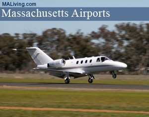
Worcester Regional Airport
Mass. Airports & Landing Strips
The Worcester Regional Airport was originally constructed in 1925. It had two gravel runways and was used for leisure travel. Due to it’s success, the owners decided that an expansion was in order. In 1946, the site of the airport was moved to another location and has been serving the public ever since. There are 2 runways; 11/29 measuring 7,000 x 150 ft (2,134 x 46 m) and 15/33 measuring 5,000 x 100 ft (1,524 x 30 m). Feature your local business in MA Living, contact us.
Worcester Regional Airport: MA Airports

Worcester Regional Airport
5375 Airport Dr.
Worcester, MA 01602
Ph: 508-799-1350
Location
FAA Identifier: ORH
Lat/Long: 42-16-02.4220N / 071-52-32.5540W
42-16.040367N / 071-52.542567W
42.2673394 / -71.8757094
(estimated)
Elevation
1009 ft. / 307.5 m (surveyed)
Variation: 15W (1995)
From city: 3 miles W of WORCESTER, MA
Time zone: UTC -5 (UTC -4 during Daylight Savings Time)
Zip code: 01602
Airport Operations
Airport use: Open to the public
Activation date: 02/1946
Sectional chart: NEW YORK
Control tower: yes
ARTCC: BOSTON CENTER
FSS: BRIDGEPORT FLIGHT SERVICE STATION
NOTAMs facility: ORH (NOTAM-D service available)
Attendance: CONTINUOUS
Wind indicator: yes
Segmented circle: yes
Lights: DUSK-DAWN
ACTVT HIRL RY 11/29; MIRL RY 15/33; MALSR RY 11 & PAPI RYS 29 & 33 – CTAF.
Beacon: white-green (lighted land airport)
Landing fee: yes, LANDING FEE FOR MULTI-ENGINE ACFT AND LARGER.
Fire and rescue: ARFF index B
International operations: customs landing rights airport
2 HRS ADVANCE NOTICE REQUIRED FOR CUSTOMS.
Airport Communications
CTAF: 120.5
UNICOM: 122.95
ATIS: 126.55(508)757-0962
WX ASOS: PHONE 508-795-7546
WORCESTER GROUND: 123.85 [0630-2100]
WORCESTER TOWER: 120.5 263.0 [0630-2100]
BRADLEY APPROACH: 119.0
BRADLEY DEPARTURE: 119.0
CLEARANCE DELIVERY: 119.0 128.65
EMERG: 121.5 243.0
WHEN ATCT CLOSED: 119.0
WX ASOS at FIT (18 nm N): 135.175 (978-343-9121)
Airport Services
Fuel available: 100LL JET-A
Parking: hangars and tiedowns
Airframe service: MAJOR
Powerplant service: MAJOR
Bottled oxygen: NONE
Airport Operational Statistics
Aircraft based on the field: 102
Single engine airplanes: 94
Multi engine airplanes: 6
Helicopters: 2
Aircraft operations:
avg 161/day
48% local general aviation
46% transient general aviation
5% air taxi
<1% military
<1% commercial
inns | hotels | resorts | rentals | attractions | dining | real estate
SHOP FWM LUGGAGE SALE
| Photo | Title | Price | Buy |
|---|---|---|---|

|
Badgley Mischka Diamond Hard Expandable Spinner Luggage Set (3 Piece) (Burgundy-Black Bars) | On Sale | |

|
NZBZ Vintage Luggage Sets Luxury Cute Suitcase Retro Trunk Luggage with TSA Lock for Men and Women 3 Pieces (Dark Green, 14" & 20" & 28") | On Sale | |

|
DELSEY Paris Chatelet Air 2.0 Hardside Luggage with Spinner Wheels, Angora, 2 Piece Set 21/28 | $524.99 | On Sale |

|
SwissGear 7739 Hardside Luggage Trunk with Spinner Wheels, White, 2-Piece Set (19/26) | $199.99 | On Sale |

|
DELSEY Paris St. Tropez Hardside Expandable Luggage with Spinner Wheels, Navy, 3-Piece Set (21/24/28) | $553.23 | On Sale |

|
DELSEY Paris Helium Aero Hardside Expandable Luggage with Spinner Wheels, Titanium, 3-Piece Set (19/25/29) | $499.99 | On Sale |

|
kensie Hudson Softside Spinner Luggage, Heather Gray, 3-Piece Set (16/20/28) | $164.43 | On Sale |

|
Travelpro Runway 2 Piece Luggage Set, Carry-on & Convertible Medium to Large 28-Inch Check-in Hardside Expandable Luggage, 8 Spinner Wheels, TSA Lock, Hardshell Suitcase, White | $269.99 | On Sale |

|
DELSEY Paris Titanium Hardside Expandable Luggage with Spinner Wheels, Graphite, 3-Piece Set (21/25/29) | $876.61 | On Sale |

|
Bric's Bellagio 2.0 Spinner Trunk - 32 Inch - Luxury Bags for Women and Men - TSA Approved Luggage - Olive | $498.00 | On Sale |

|
Bric's Bellagio 2.0 Spinner Trunk - 27 Inch - Luxury Bags for Women and Men - TSA Approved Luggage - Olive | $438.00 | On Sale |

|
KPL Large 32 inch duffel bags for men holdall leather travel bag overnight gym sports weekend bag | $98.99 | On Sale |

|
Genuine Leather Duffel | Travel Overnight Weekend Leather Bag | Sports Gym Duffel for Men (BROWN) | Leather Vacation Luggage Duffle Bag | $69.99 | On Sale |

|
Polare 23" Full Grain Cowhide Leather Gym Duffle Weekender Overnight Travel Duffel Bag For Men 42L | $199.99 | On Sale |

|
Leather Rolling Travel Duffle Bag for Men Women 21 inch with wheels Sports Overnight Weekend Duffel Gym Cabin Holdall with wheels for easy carry | $189.99 | On Sale |
Inns | Hotels | Resorts | Vacation Rentals
Real Estate | Products
Dining | Attractions | Business
History | Weather | Beaches
Fishing | Golfing | Towns
Art Galleries | Massachusetts Shopping
Free World Mall
Country Weddings | New England Recipes
Red Sox Gifts | Travel Destinations | New England Living


